We provide accurate, build-ready network plans using advanced geospatial data and analysis..
Using QGIS and real-world data, we produce both High-Level Designs (HLD) and Low-Level Designs (LLD) that guide your fibre build from concept to completion. Our planning integrates surface type data, utility locations, and infrastructure overlays to support feasibility, compliance, and costing. we’re highly adaptable and can quickly integrate with your preferred systems—whether that’s 3GIS, QField, or bespoke custom platforms.
Our goal is to align with your tech stack to deliver seamless, compatible outputs that meet your operational requirements.
Route mapping using QGIS or your preferred option
QField integration for live field data capture
Interactive GIS dashboards for planning teams
Automated reports: SHP, KML, as-builts, and fibre maps
Every project is backed by clear, compliant, and audit-ready documentation.
• Design & GIS Updated route maps, PIA asset checks, SHP/KML files, SLDs.
• Compliance Packs A55s, BOMs, Cable & Civils Packs, Splicing Sheets, As-Builts.
• Risk & Safety Risk assessments, surface reports, utility hazard mapping.
• PIA Evidence RAG status reports, PIA Portal updates, photographic proof, usage logs.
• Photo Records Geo-tagged images of all infrastructure (poles, chambers, cabinets, obstacles, entry points).
Physical fibre build and testing, delivered to PIA and other altnet standards.
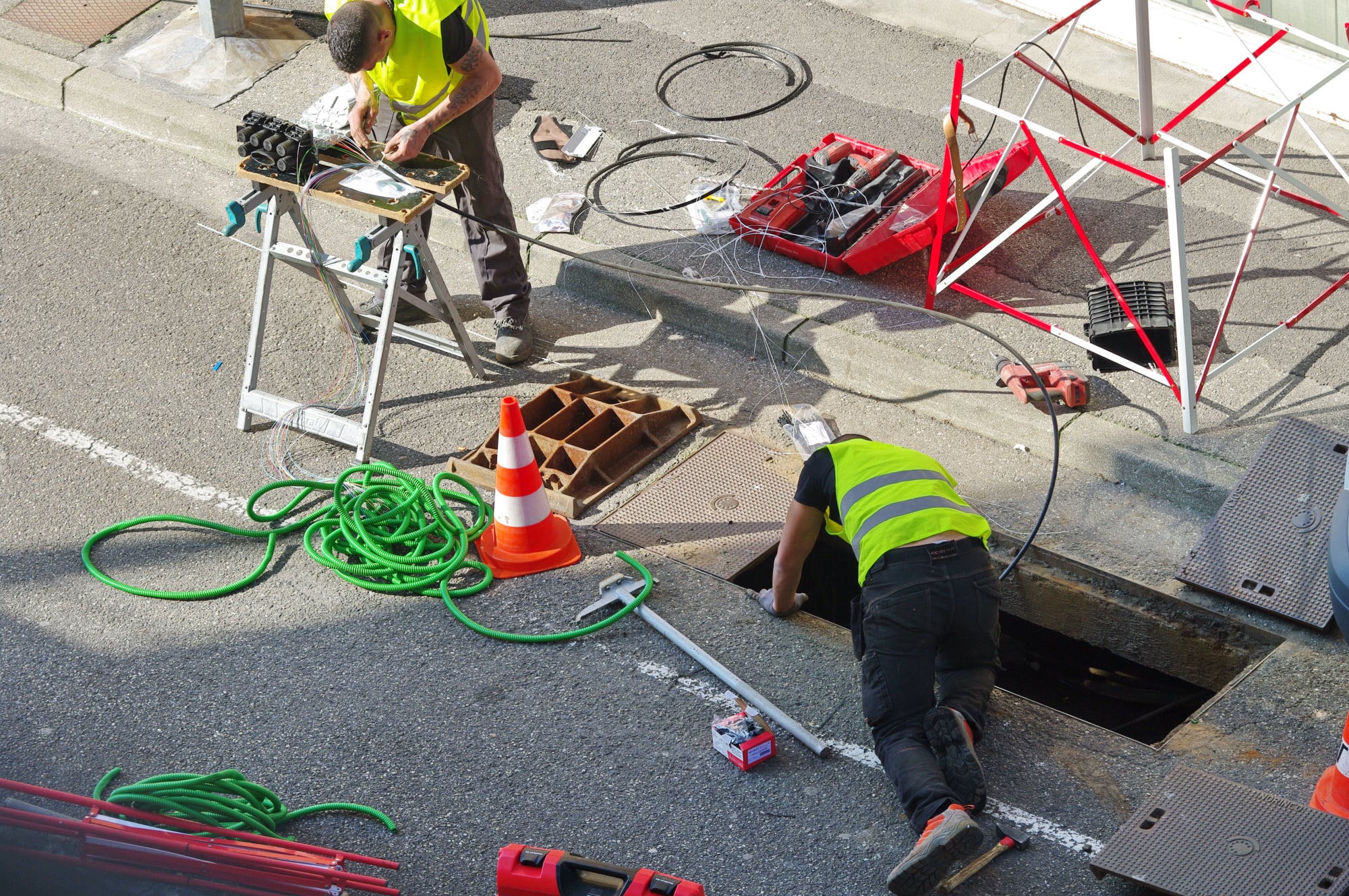
We oversee all aspects of fibre installation, from cable pulling to OTDR testing. Every installation is backed by documented splicing records, tray assignments, and termination details, to ensure client-specific requirements.
Includes:
• Fibre cable installation (blown and pulled)
• Jointing, splicing & fibre tray management
• Testing & certification (light loss, OTDR)
• NTE, cabinet & equipment installation
Specialist delivery for fibre into multi-dwelling units.
We survey, design, and implement fibre infrastructure for Multi-Dwelling Units (MDUs), ensuring connectivity from street to tenant with minimal disruption. We work closely with landlords to support wayleave access and internal routing.
Capabilities:
• Internal fibre design (LLD for MDUs)
• Entry point planning & cabinet placement
• Wayleave liaison with landlords & property managers
• Routing for both communal and in-flat cabling
On-the-ground validation using QField, GPS, and industry-standard tools.
Our surveyors walk every route, capturing critical information to verify duct, pole, and chamber availability in line with Openreach build standards. We assess surface types, hazards, congestion, and address data to ensure accurate delivery of as-built records and build packs.
Services Include:
• Duct/pole condition checks, SEDs, and congestion logging
• Surface type and utility mapping (gas, water, electric)
• UPRN verification and access confirmation
• Geo-tagged site photography
• Space validation for cabinets, joints, and termination points on new and old networks